High-resolution methane emissions data for waste management.

Copernicus Sentinel-5P’s high revisit rate combined with GHGSat’s high-resolution commercial imagery can give landfill operators and regulators the information they need to reduce methane emissions from landfill sites.
As a potent greenhouse gas, methane is becoming an increasing concern. Later this year, the EU will issue a Methane Strategy, which includes uncontrolled emissions from landfill sites as a priority target for reducing methane emissions within the European Green Deal.
Accurate measurements of concentrations of methane are key to identifying particular sources and to adopting strategies to mitigate emissions. Until now, however, satellite systems measuring methane have been of insufficient resolution to attribute emissions from individual landfill sites.
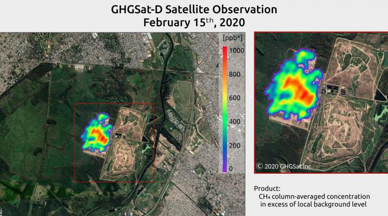
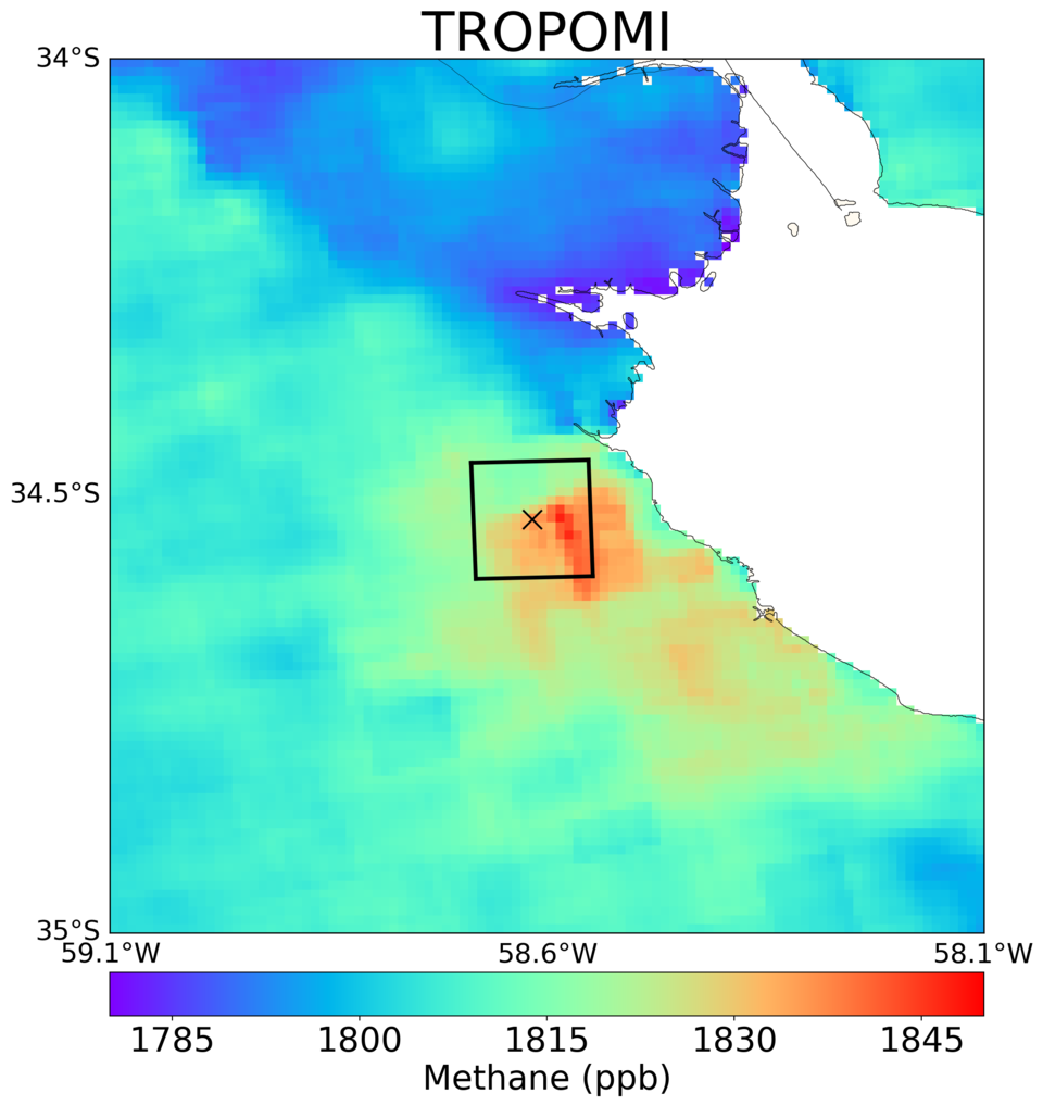
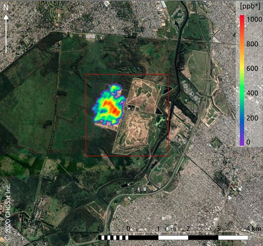
Working with Benito Roggio Ambiental (BRA), the waste management operator responsible for one of the largest landfill sites in South America, and the Netherlands Institute for Space Research (SRON), scientists have been analysing Sentinel-5P data to guide GHGSat’s demonstration high-resolution satellite, Claire, to measure methane emissions from individual waste management facilities.
GHGSat’s new Iris satellite, which was taken into orbit on 2 September on ESA’s Vega rocket, provides even higher spatial resolution and improved detection to collect methane measurements for smaller sources.
Copernicus Sentinel-5P’s high revisit rate combined with GHGSat’s high-resolution imagery is enabling new analytics solutions that can support landfill operators and regulators reduce the cost of inspection, regularly screen for emissions and identify opportunities to recover landfill gas, for example.
Scientists from SRON and GHGSat are developing synergetic approaches for monitoring methane emission sources including waste management facilities in the EU and globally.
The Sentinel-5P data analysed by SRON can be used to point high-resolution instruments such as GHSat’s demonstration satellite Claire and its new Iris satellite towards large methane sources. With these advances in high-resolution data and new analytics approaches, ESA anticipates significant progress on this practical application in the coming months and years.

Rodrigo Pontiggia, BRA Development and Innovation Manager says, “BRA has various initiatives to safely collect and use land-fill gas from the Norte III site. The size of the landfill presents unique challenges and we are impressed with the early results that GHGSat has delivered to characterise our methane emissions.
“We look forward to exploring the enhanced capabilities presented by Iris and the ways in which we can incorporate GHGSat data into our operations on a recurring basis.”
GHGSat’s Director of Business Development (Europe), Adina Gillespie, comments, “Together with BRA, we will initiate a new project to collectively evaluate Iris data for achievable commercial as well as operational integration into management of the Norte III landfill site. This project will build on the current ESA study being undertaken by the UK National Physical Laboratory and GHGSat.”
The ESA study is using methane measurements of a UK landfill site to evaluate satellite and ground measurement capability for its applicability to monitoring oil & gas pipelines. The results from this study will help guide the BRA follow-on developments.
In anticipation of the data from Iris, ESA, the Canadian Space Agency and GHGSat have teamed up through an announcement of opportunity to make 5% of the data available for research purposes, including waste management studies.

17 September 2020
esa


