Fragile Planet: documenting the impact of the climate crisis – in pictures.
10 10 2020 | 09:34

Fragile Planet is a record of the dramatic changes that are shaping our planet. Containing more than 230 photographs, the book documents the effects of climate systems and forces of nature on our world alongside striking images that show their impact.
e
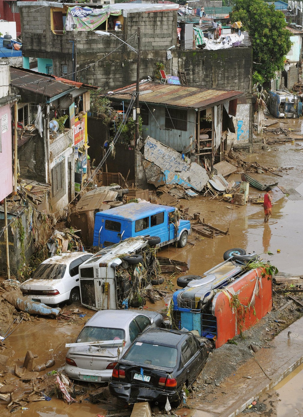
On average, the Philippines is hit by 20 typhoons each year. In September 2009, Typhoon Ketsana brought 144km/h (90mph) winds and more than a month’s rainfall to Manila in just six hours. Flood waters in some areas of Manila and Marikina City reached the second floors of homes, forcing people to clamber on to roofs. Millions of people were affected by the storm and hundreds killed
Photograph: Newscom/Alamy


e
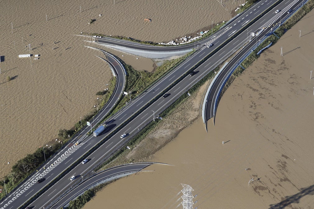
In October 2019, Japan was pummelled by one of the most powerful storms to hit the country in decades – Typhoon Hagibis. Gusts reached 225km/h (140mph) and multiple rivers burst their banks, flooding many communities. When the typhoon made landfall on 12 October in the Izu peninsula, about half a million homes experienced power cuts
Photograph: Newscom/Alamy


r
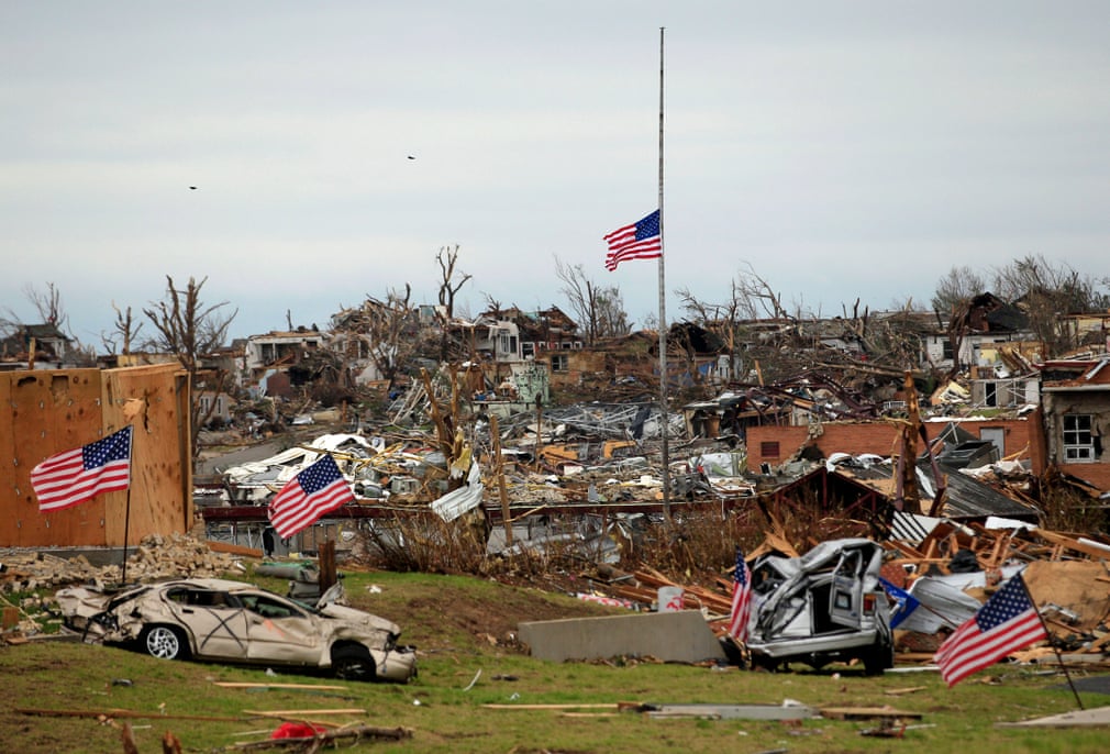
On 22 May 2011, a catastrophic tornado whipped through Joplin in Missouri, destroying virtually everything in its path. A supercell thunderstorm created the EF-5 tornado, with wind speeds in excess of 320km/h (200mph). The tornado, thought to be the most deadly since US records began in 1950, was responsible for the deaths of 158 people and injured more than 1,000
Photograph: Charlie Riedel/AP


f
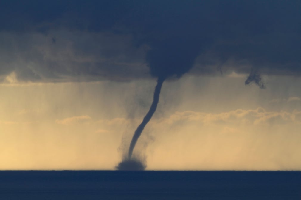
This waterspout was seen in the Mediterranean Sea, just off the Côte d’Azur in France. Waterspouts are formed when the air in a cloud rotates and then emerges as a funnel. Gradually the funnel extends downwards until it reaches the surface of the sea and a waterspout is formed. If this had taken place over land it would have become a tornado with the likelihood of damage occurring. It is common for one weather system to spawn several tornadoes, resulting in devastation over a considerable area as the system crosses the country
Photograph: ImageBroker/Alamy


t
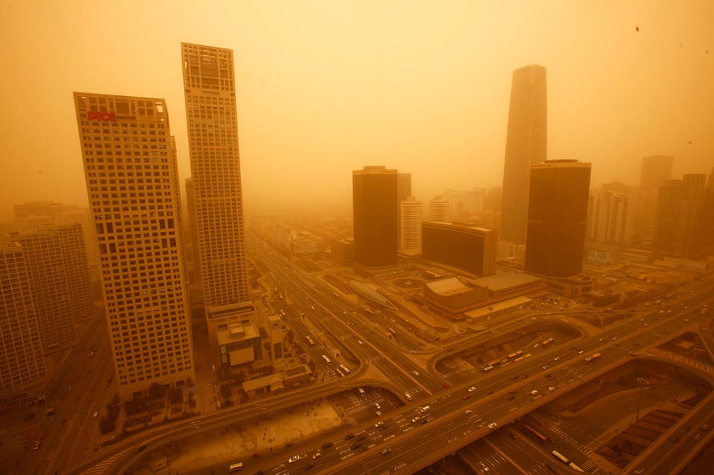
When spring winds blow in from the Gobi desert, they often carry large amounts of sand dust eastward towards Beijing and onwards to the Korean peninsula, and even as far as Japan
Photograph: Wenn Rights/Alamy


h

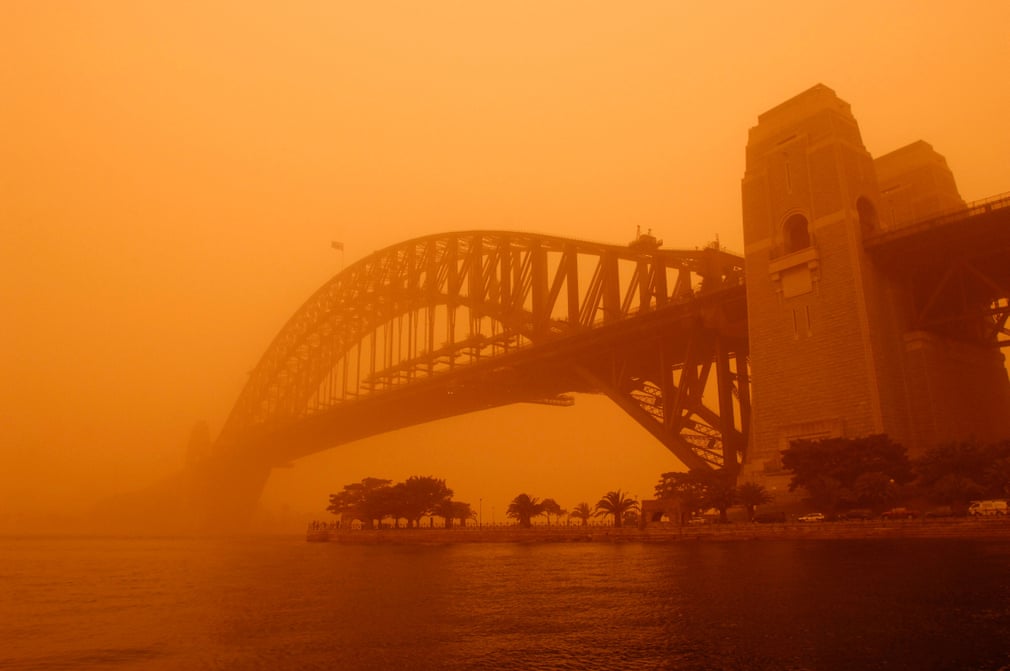
At the peak of this duststorm, air particle concentration levels hit 15,400mg/m3 of air. To put this in context, normal days register about 20mg/m3 and bushfires can produce 500mg/m3. It was estimated that about 16m tons of dust were picked up from Australia’s deserts, and during the worst parts of the duststorm, nearly 75,000 tons of dust were being lost off the New South Wales coast every hour
Photograph: Redbrickstock.com/Alamy
FacebookTwitterPinterest
 

j
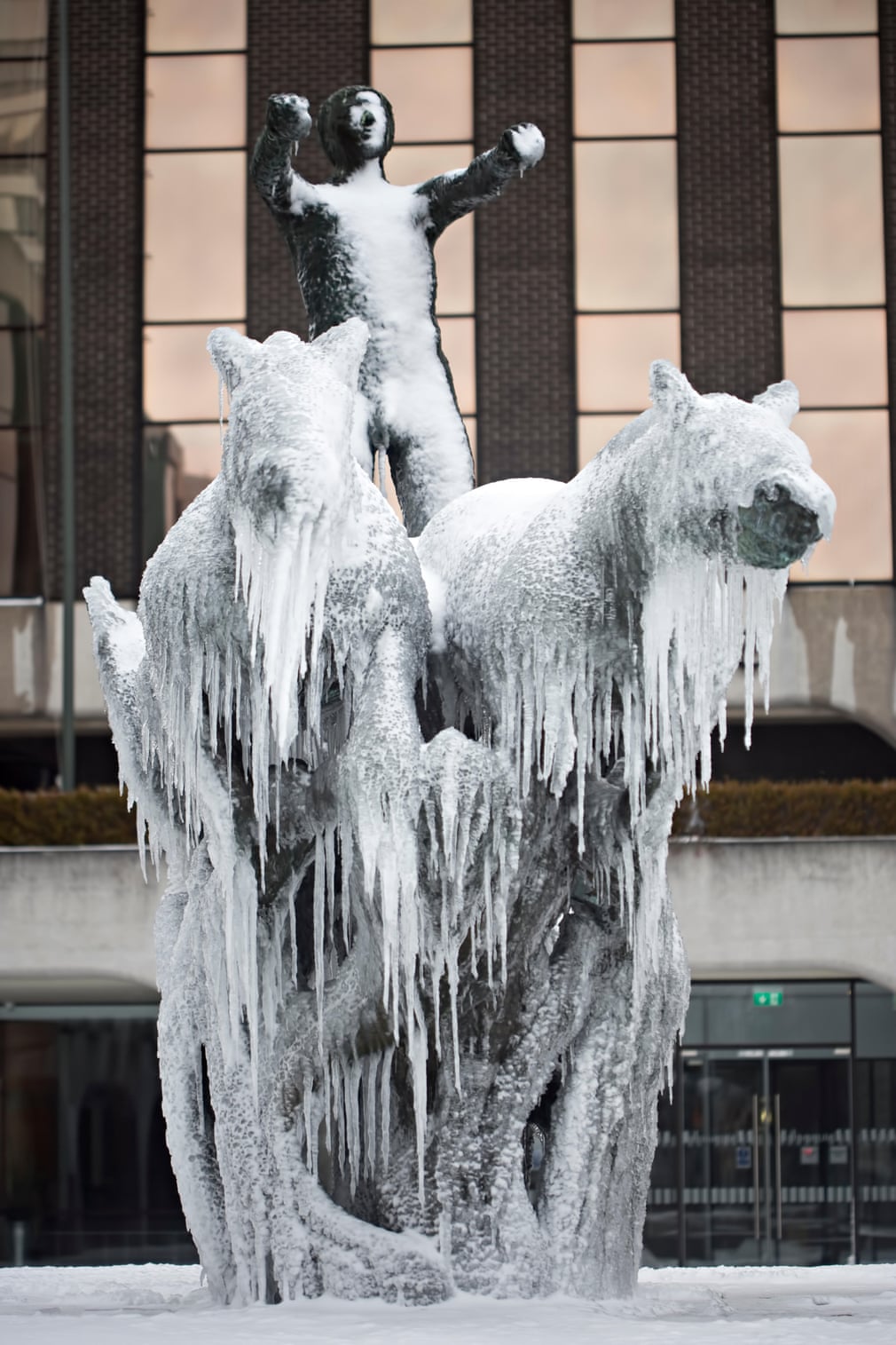
The intensely cold weather system colloquially known as the ‘Beast from the East’ combined with Storm Emma in March 2018 to cause widespread disruption across the whole of the British Isles. In Dublin, Ireland, the Chariot of Life fountain on Abbey Street was covered in icicles and snow
Photograph: Bartosz Luczak/Alamy


k
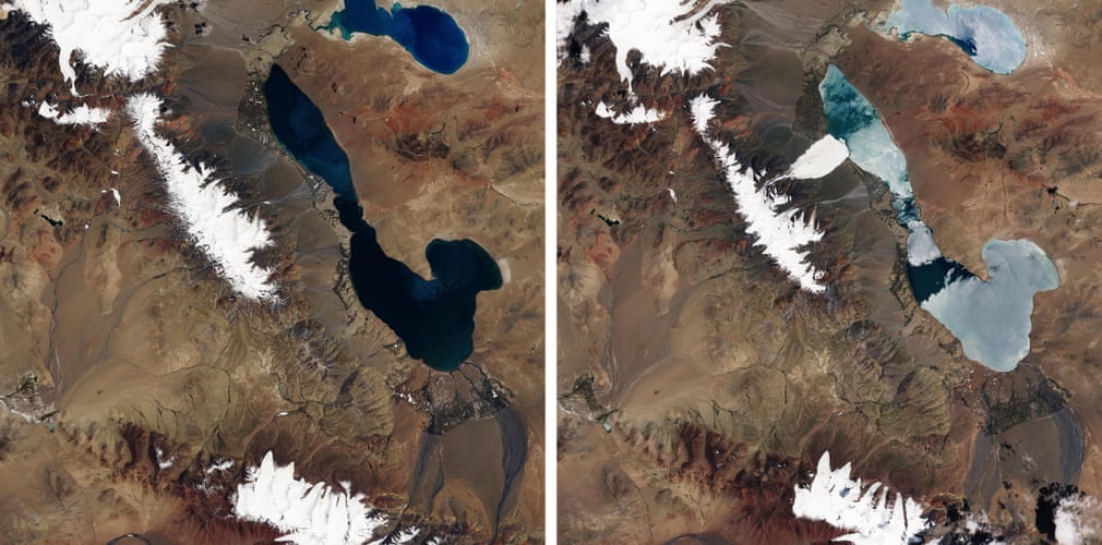
The satellite image on the left shows the Aru mountain image range before a glacier collapse. The image on the right captures the collapse and the resulting ice avalanche in action, one of the biggest recorded. It devastated everything in its path and left debris 30 metres (98 feet) deep, covering an area of 10 sq km (4 sq miles). Nine people from the village of Dungru were killed along with hundreds of sheep and yaks
Photograph: Nasa


l
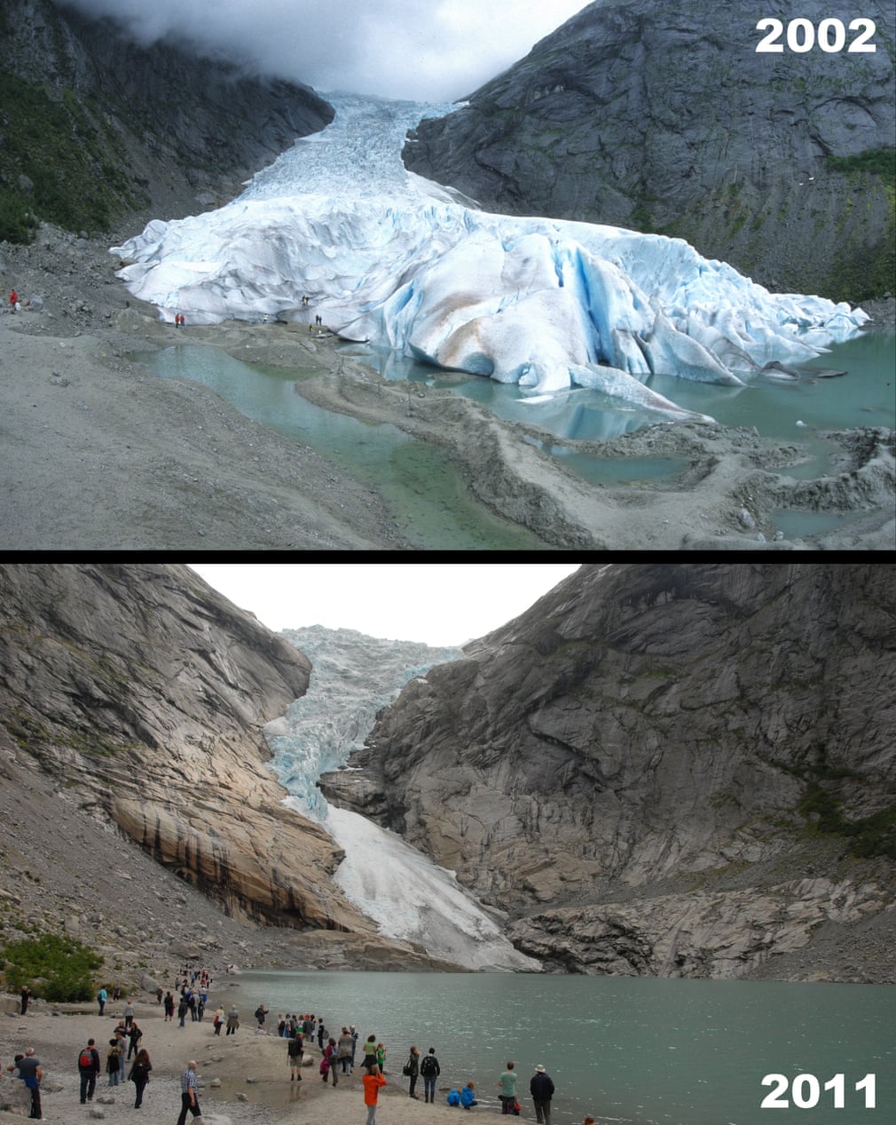
Briksdalsbreen, known in English as the Briksdal glacier, branches off the Jostedalsbreen glacier in Jostedalsbreen national park in Norway. Briksdalsbreen’s terminus is in a glacial lake, Briksdalsvatn, which is about 346 metres (1,135ft) above sea level. Many of Norway’s glaciers are vulnerable to rising global temperatures. By 2007, the front of the glacier had retreated so far back that it sat on dry land rather than in the glacial lake
Photograph: Robert Harding/Alamy


k
Extending over Chile and Argentina, the southern Patagonian icefield is the southern hemisphere’s biggest icefield outside of Antarctica, at approximately 13,000 sq km (5,000 sq miles). Most of its glaciers have retreated over the years and some are in grave danger. The glacier, named HPS-12, has experienced catastrophic retreat. In 1985, it was about 26km (16 miles) long, but in 2017 it was only 13km (8 miles) long, meaning that in the 33 years between the two images, the glacier lost about half its volume and detached from three other glaciers
Photograph: Nasa


f
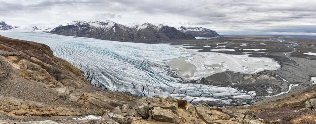
Skaftafellsjökull, in Iceland’s Skaftafell national park, is a glacier tongue that juts from Iceland’s biggest ice cap – Vatnajökull. The ice cap currently covers about 8% of Iceland’s surface area. Unfortunately, over the past couple of decades, Skaftafellsjökull has been in rapid retreat due to global heating. Between 1995 and 2019 the glacier retreated about 850 metres (2,790ft), and at this rate the glacier can be expected to shrink by 50-100 metres each year
Photograph: Eric Middelkoop/Alamy


f
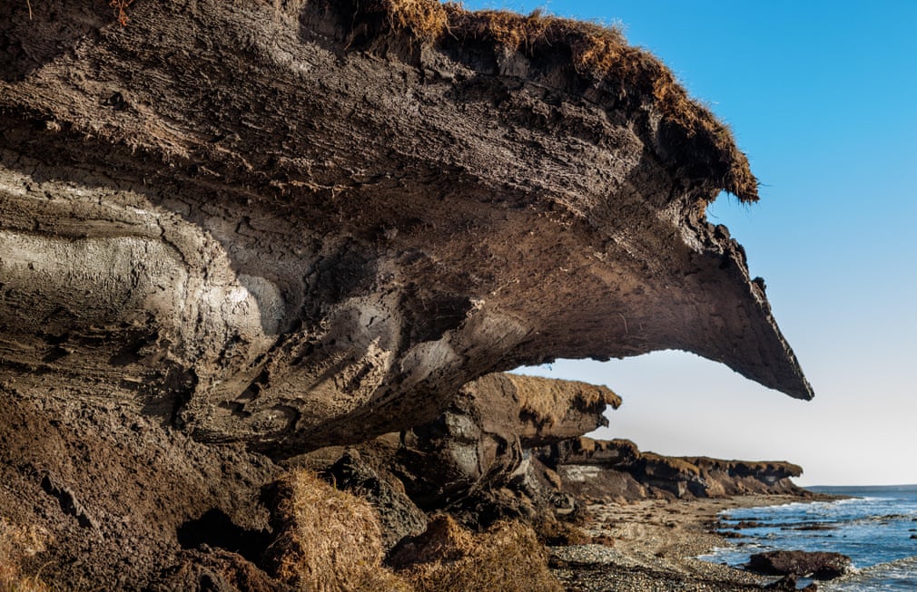
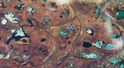
Permafrost – frozen ground that stays frozen for a minimum of two years – is found in many areas of the northern hemisphere, including Alaska. In this image, former permafrost has thawed and is about to fall into the sea
Photograph: Peace Portal/Alamy


f

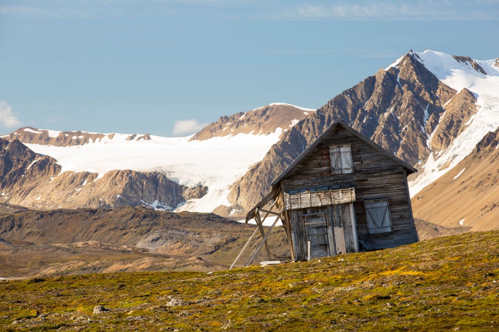
A house sliding down a thawing slope of permafrost in Spitsbergen, Norway
Photograph: Ashley Cooper/Alamy
FacebookTwitterPinterest


g
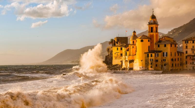
Camogli is one of the most picturesque towns in Liguria, Italy, with a church that overlooks the sea. During great storm surges, the waves crash against its walls
Photograph: Paolo Bolla/Alamy


f
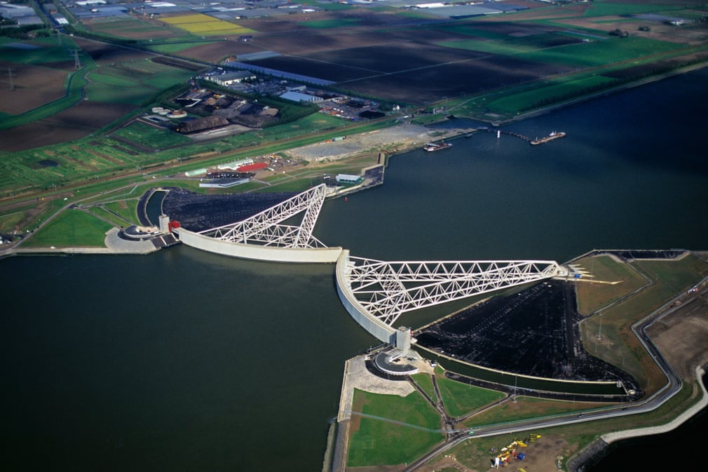
Much of the Netherlands sits below sea level. As a result, it is extremely vulnerable to the ever-rising sea levels attributed to global heating. In the late 1980s, Dutch authorities decided that if they did not act, the Netherlands could face more widespread flooding, and would ultimately run the risk of large areas disappearing under water. Installation of the Maeslant storm surge barrier was completed in 1997 to protect against floods
Photograph: Frans Lemmens/Alamy


f
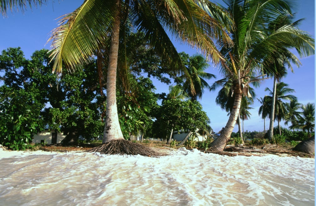
Likiep Atoll is a coral atoll in the Pacific Ocean’s Marshall Islands, home to about 400 people. It is also the site of the highest point on the Marshall Islands – a knoll that stands only 10 metres (30ft) above sea level. It is no surprise, therefore, that this atoll, and the Marshall Islands as a whole, are extremely vulnerable to rising sea levels as a result of global warming. The homes behind the line of trees above are about to be inundated by the rising tide
Photograph: Photofusion Picture Library/Alamy
 

d
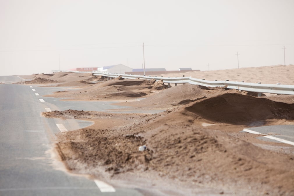
Inner Mongolia is China’s third largest province, and much of this autonomous region is in the Gobi desert. The desert is growing at a rapid rate through desertification
Photograph: Global Warming Images/Alamy
 

f
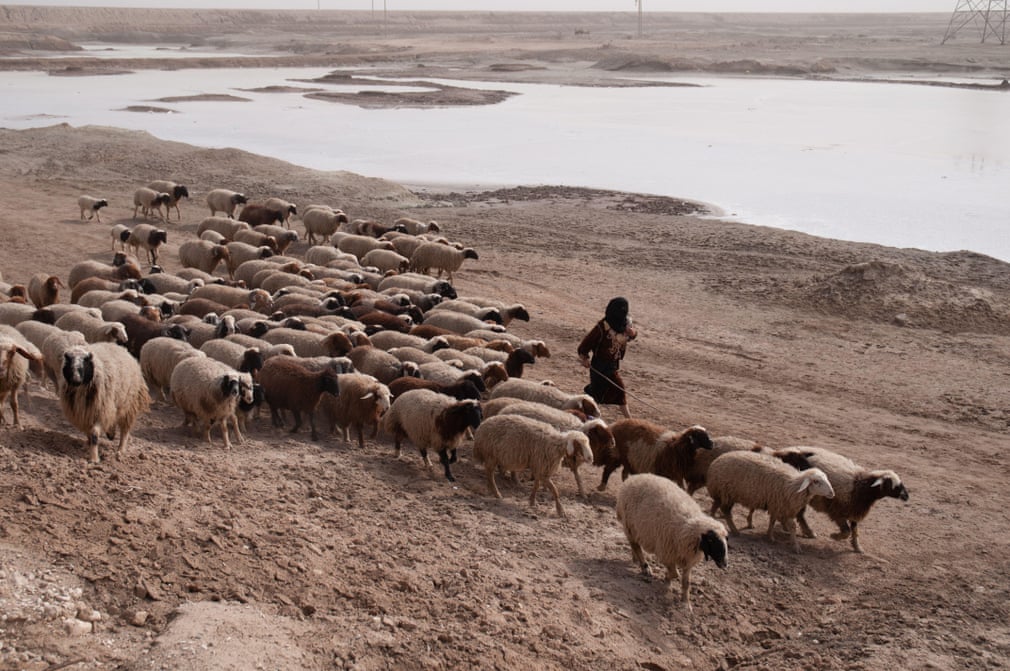
Basra in Iraq used to have a similar climate to southern Europe. The Shatt al-Arab River helped maintain vast areas of marshland and sustained millions of palm trees, which provided an income for many from the cultivation and sale of dates. But now, as a result of climate damage, years of war, oil exploration forcing farmers off their land, and salty water making its way back inland because of an increased number of dams, most of Iraq’s marshland and fertile land has turned to desert
Photograph: Stephen Foote/Alamy


g
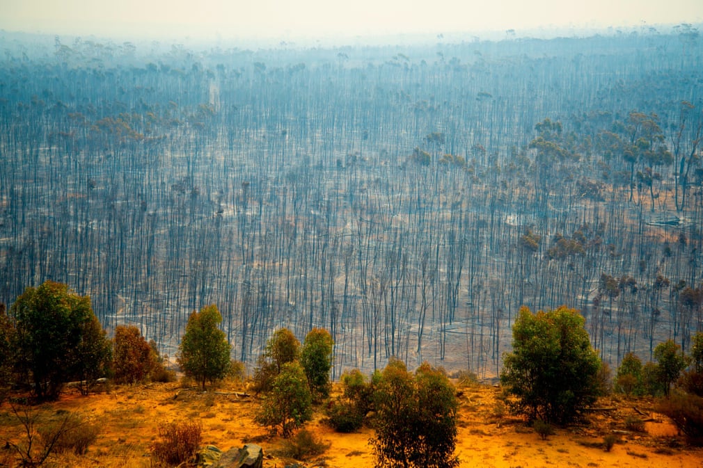
Bushfire devastation in Australia. Destructive blazes spread rapidly across a range of habitats, usually as a result of prolonged periods of dry weather
Photograph: Adwo/Alamy


d
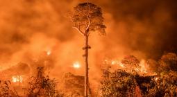
In mid-July 2016, 50 sq km of land were lost to the Lava Mountain fire in Wyoming’s Shoshone national forest in the US. The blaze was sparked by a lightning strike and grew steadily for the first two weeks. But when the temperatures and winds increased, the fire’s rate of spread accelerated considerably
Photograph: Kristen Honig/USFS


g

Drought conditions in Guadalajara, Spain
Photograph: Agefotostock/Alamy
FacebookTwitterPinterest


f
Alassa church had to be relocated when the Kouris dam and reservoir were created in Cyprus in 1989. Normally, when the reservoir is full, only the spire of the church is visible, but in times of persistent drought, as in the case here in 2008, the old church can be seen above water in its entirety
Photograph: Rodger Tamblyn/Alamy


φ

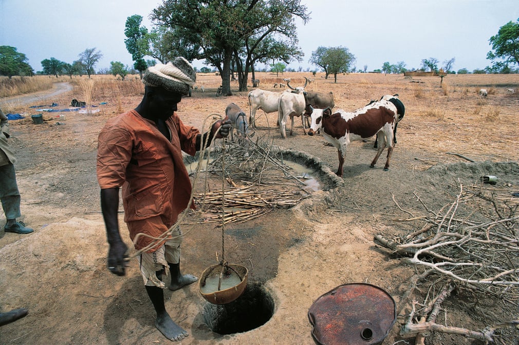
In Burkina Faso, the lowering of the water table due to drought necessitates the deepening of wells to collect enough water to sustain communities
Photograph: DeAgostini/Alamy
FacebookTwitterPinterest


γ
At times of high water, Lake Poopó in the Altiplano Mountains of west-central Bolivia is the country’s second-largest lake. At its original capacity, it was about twice the size of London, UK. The lake is a vital resource to the area local: many people fish in it to make a living. It dried up in 1994, but gradually filled back up after a few years, although it took a long time for its ecosystems to be restored. It has now dried up again, and the image from 2016 shows the lake in stark contrast to how it looked in 2013
Photograph: Nasa


φ
In winter, Shishmaref’s shoreline is protected by sea ice. In summer months, however, there is much less ice and the coastline suffers as a result. The permafrost that the village is built on is also melting. This makes the shore much more vulnerable to erosion. Recent erosion rates average about 3.3 metres (10ft) a year, and buildings are being lost. The community is now faced with moving the village’s location or building sea walls, like the one shown above, to give themselves some of the protection once afforded by the sea ice
Photograph: Global Warming Images/Alamy


ξ
The impressive Duncansby Stacks can be found off the northern tip of Scotland’s coast. They are a group of sea stacks that have been eroded over many years from the mainland’s red sandstone cliffs. Once, they would have formed part of the cliffs now beside them. Typically stacks are formed when cliffs erode into headlands, in which caves then form. When caves break through a headland, a sea arch is formed; then when an arch collapses a sea stack is left
Photograph: RooM the Agency/Alamy


γ
The town of St Ives in Cambridgeshire surrounded by flood water after the River Great Ouse burst its banks
Photograph: Geoff Robinson


φ
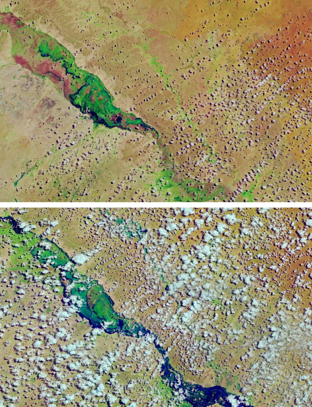
Much of Somalia was affected by floods in April 2018, which devastated many parts of the country when the Shebelle River burst its banks. Houses and crops were destroyed in what is thought to be one of the worst floods ever recorded
Photograph: Nasa


φ
Many South American cities are have some of the poorest air quality in the world. Lima, pictured, has high levels of air pollution. In 2019, it was estimated that 690 of every 100,000 children in the Peru capital would develop a respiratory condition – most commonly asthma – as a result of the harmful levels of nitrogen dioxide emitted from vehicles
Photograph: Izel Photography/Alamy


δ

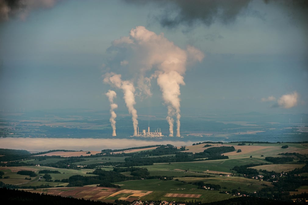
The Polish government is devoting billions towards finding alternative, cleaner heat sources to traditional coal heating. The fossil fuel is not just a domestic issue – many power plants across the country rely on coal to generate energy. The image shows a coal-fired power plant in Turów, which generates about 8% of Poland’s electricity
Photograph: CTK/Alamy
FacebookTwitterPinterest


ι
In 2018, South Korea hosted the Winter Olympics and, in order to do so, had to create an alpine centre, pictured, to host events. Many South Koreans expressed their anger at the organisers for destroying the 500-year-old forest on the slopes of Mount Gariwang to make way for the venue
Photograph: UPI/Alamy


γ

Green algae in Puy-de-Dôme, France
Photograph: Emmanuel Lattes/Alamy
FacebookTwitterPinterest


γ
India imposed a national Covid lockdown at the end of March 2020. Halting the activity of about 1.3 billion people not only helped reduced the spread of the virus but also cut pollution levels. When Delhi was shut down, a temporary decrease in air pollution allowed landmarks to be seen more clearly, as is illustrated here in the images of the India Gate before the pandemic, right, and during it
Photograph: Getty Images


8 October 2020

Τhe Guardian