Lake Chad's shrinking waters.
- Title Lake Chad’s shrinking waters
- Released 22/03/2019 10:00 am
- Copyright contains modified Copernicus Sentinel data (2018), processed by ESA (For Landsat image: USGS/ESA), CC BY-SA 3.0 IGO
- Description
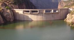
The 22 March is World Water Day, which focuses on the importance of freshwater. The Sustainable Development Goals of the United Nations aim to achieve a better and more sustainable future. Goal number 6 focuses on ensuring the availability and sustainable management of water for all by 2030. This image takes us over Lake Chad at the southern edge of the Sahara, where water supplies are dwindling.
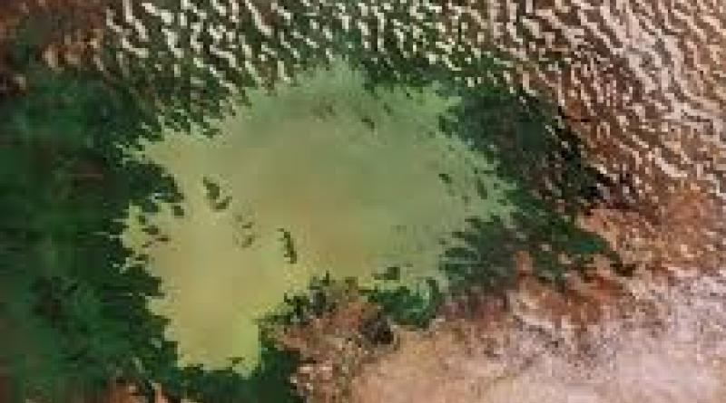
This comparison shows Lake Chad imaged on 6 November 1984 by the US Landsat 5 satellite and on 31 October 2018 by the Copernicus Sentinel-2A satellite. The rapid decline of the lake’s waters in just 34 years is clear to see.
Once one of Africa’s largest lakes, Lake Chad has shrunk by around 90% since the 1960s. This receding water is down to a reduction of precipitation, induced by climate change, as well as development of modern irrigation systems for agriculture and the increasing human demand for freshwater.
Straddling the border of Chad, Niger, Cameroon and Nigeria, the lake is a major source of freshwater for millions of people in the area. It is also a source for irrigation, fishing and it was once rich in biodiversity.
As the lake continues to dry up, many farmers and herders move towards greener areas or move to larger cities to seek alternative work. Several attempts have been made to replenish these shrinking waters, however little progress has been achieved.
The borders of the lake’s body are only partly visible in the most-recent image – as the majority of the shoreline is swamp and marsh. The Chari River, visible snaking its way towards Lake Chad at the bottom of the image, provides over 90% of the lake’s waters. It flows from the Central African Republic following the Cameroon border from N'Djamena, where it joins with its main tributary the Logone River.
The demand for water is growing inexorably. Access to water is vital – not only for drinking, but also for agriculture, energy and sanitation. By providing measurements of water quality and detecting changes, the Copernicus Sentinel-2 mission can support the sustainable management of water resources.
These images are also featured on the Earth from Space video programme.
UN Sustainable Goal 6 is crystal clear: Water for all by 2030. SDG6 includes a target to ensure availability and sustainable management of water for all by 2030. For World Water Day we take a look at ways that space can help this global challenge. While Earth-observing satellites monitor our precious water resources, technologies developed for human space missions also serve global needs in harsh environments here on Earth.
22 March 2019