Iceberg on collision course with South Georgia.

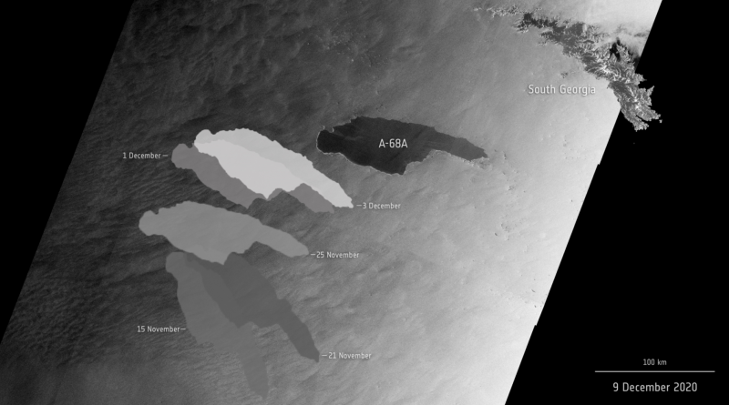
The giant A-68A iceberg could strike land this month – wreaking havoc near the waters of the South Georgia Island.
Since its ‘birth’ in 2017, the iceberg has travelled thousands of kilometres from the Larsen C ice shelf, in Antarctica, and now lies around 120 km from South Georgia. If it remains on its current path, the iceberg could ground in the shallow waters offshore – threatening wildlife, including penguins and seals.
Satellite missions are being used to track the berg on its journey over the past three years. The Copernicus Sentinel-1 radar mission, with its ability to see through clouds and the dark, has been instrumental in mapping the polar regions in winter.
Video credits:
Animation: contains modified Copernicus Sentinel data (2017-18), processed by Swansea University-A. Luckman
Radar images: contains modified Copernicus Sentinel data (2020), processed by ESA, CC BY-SA 3.0 IGO
A-68A map: contains modified Copernicus Sentinel data (2020), processed by ESA; Antarctic Iceberg Tracking Database
Sentinel-1 animations: ESA/ATG Medialab
Penguins footage: Getty
11 December 2020
esa


