GIS-driven Digitalisation: Unlocking the power grid

Data-rich, GIS-driven digitalisation forms a strong base for integrated, intelligent grid management
Utilities around the world are increasingly adopting technologies such as substation and distribution automation, smart metering, advanced outage management systems, and predictive maintenance tools.
While these advancements are transforming grid operations, one often overlooked but powerful enabler lies at the very foundation of digital transformation: Geospatial Information Systems (GIS).
A robust, data-rich GIS provides a spatial view of all grid assets and stakeholders, forming the base for integrated, intelligent grid management.
Unlike standalone digital tools, GIS connects physical assets, geography, population and socioeconomic data into one unified environment for analysis, visualisation and informed decisions. This integration delivers insights that support efficient operations, planning, and service delivery.
However, digital tools are only as effective as the data they rely on. The power of a GIS-centric approach depends on clean, structured data. Without it, even the most advanced tools produce limited or unreliable results.
Therefore, strong data collection and validation are essential. With accurate, real-time data, GIS evolves into a dynamic spatial intelligence engine—simplifying thousands of data points into interactive dashboards or generating insights from a single prompt. This empowers utilities to manage complexity and maximise existing system value.
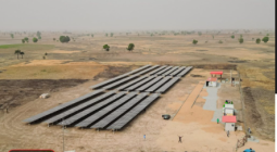
Kenya provides a compelling case study. The national utility and Ministry of Energy use GIS to visualise infrastructure and overlay it with demographic, topographic, and economic data. From identifying least-cost pathways to prioritising mini-grid investments or planning grid extensions, GIS supports evidence-based planning that aligns infrastructure with community needs.
Possible applications of GIS in the energy sector
Operations and maintenance: GIS provides spatial context for root-cause analysis by integrating factors such as terrain, vegetation, and infrastructure age. Predictive maintenance becomes more targeted, resulting in reduced downtime and improved reliability.
Investment planning: By integrating data from generation, transmission, and distribution systems, GIS enables utilities to identify infrastructure gaps and determine the optimal locations for future investments. It allows for smarter planning that reflects real-world constraints and priorities.
Energy access expansion: GIS can overlay population, economic activity, and infrastructure data to help identify underserved areas and design cost-effective on- and off-grid electrification strategies.
Disaster preparedness and climate resilience: Utilities can use GIS to model the impact of natural disasters on infrastructure, develop contingency plans, and deploy resources more effectively.
Customer engagement and service delivery: By integrating customer data with GIS, utilities can improve response times, track complaints spatially, and enhance overall service quality.
The power of GIS lies in its flexibility and scalability
A well-developed GIS platform can evolve with the grid, supporting new technologies like electric vehicles, distributed energy resources, and real-time monitoring. It also enables cross-sector collaboration, allowing energy planners to work with urban developers, transport agencies, and health ministries—making it vital for integrated development planning.
Digitalisation is the future of power systems. But to fully realise its potential, energy professionals must recognise GIS as a strategic foundation—the spatial canvas where the entire energy ecosystem can be visualised, analysed, and optimised.
This demands investment in data accuracy and governance, integration of diverse datasets, capacity building in spatial analysis, and cross-sector cooperation. ESI
Cover photo: mikkiorso©123rf