Hurricane Larry Forms in Atlantic, Could Become ‘Major’ Storm
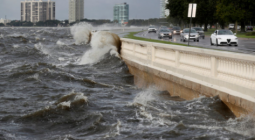
As rains from Hurricane Ida inundate the Northeast, another hurricane has formed in the eastern tropical Atlantic.
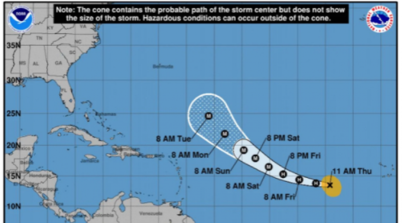
Hurricane Larry formed early Thursday, NOLA.com reported. It currently has maximum sustained winds of 80 miles per hour, according to an 11 a.m. Atlantic Standard Time (AST) update from the National Hurricane Center (NHC), making it a Category 1 storm for now.
"Steady to rapid strengthening is forecast during the next couple of days, and Larry is expected to become a major hurricane by Friday night," NHC wrote.
Further, the NHC predicted that it could reach wind speeds of 130 miles per hour by Sunday night, making it a Category 4 storm, the South Florida Sun Sentinel reported.
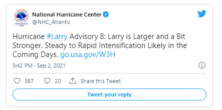
Larry first became a hurricane around 5 a.m. AST, according to the NHC. At the time, it had winds of up to 75 miles per hour. Within six hours, it had gotten "larger and a bit stronger," NHC said.
As of the most recent update, the storm is located about 660 miles west from the southernmost Cape Verde Islands. There are currently no coastal watches or warnings in effect, and NOLA.com reported that it does not immediately threaten any land.
However, the South Florida Sun Sentinel said that the forecast showed its path moving west and then northwest towards the Caribbean Sea through Sunday. Hurricane forecast maps can only predict a storm's movement five days out, but NHC said the storm could become one of the longest-running tropical systems on record.
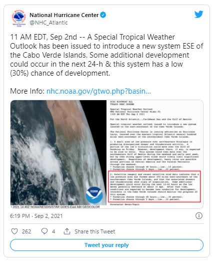
At the same time, forecasters are tracking two low pressure areas, Orlando.com reported. One has a 20 percent chance of development over the next five days and is moving towards the Yucatán Peninsula. The other formed about 300 miles east-southeast of the southernmost Cabo Verde Islands. It has a 30 percent chance of development over the next two days.
The 2021 hurricane season was forecast to be more active than usual. In early August, the National Oceanic and Atmospheric Administration (NOAA) put the chances of an above average season at 65 percent.
"A mix of competing oceanic and atmospheric conditions generally favor above-average activity for the remainder of the Atlantic hurricane season, including the potential return of La Nina in the months ahead," Matthew Rosencrans, lead seasonal hurricane forecaster at NOAA's Climate Prediction Center, said at the time.
It is not clear whether the climate crisis is making hurricanes more frequent, according to the Center for Climate and Energy Solutions. However, it does increase the chances that the storms that do form will be more dangerous, as they are wetter, more intense and slower moving.
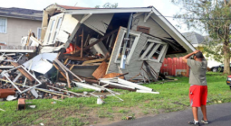
This was the case with Hurricane Ida, CNN noted.
"We've always had hurricanes, we've always had heat waves, we've always had floods and droughts, but what climate change is doing is loading the weather dice against us," Nature Conservancy chief scientist and Texas Tech University professor Katharine Hayhoe told CNN. "It's sneaking in when we're not looking, changing the numbers as we're rolling and asking what is this, how could this happen? The answer to that is climate change."
2 September 2021
ΕcoWatch