Coastal Communities in Canada Brace for Rapidly Rising Seas

As scientists track a “very abnormal and unprecedented” rate of sea level rise around the Gulf of Mexico, coastal communities in Canada are reacting to the threat of their own rising tides.
Experts warn that by 2030, 295,000 Canadians will face annual flood risks, with homes and neighbourhoods in British Columbia, the Northwest Territories, and Nova Scotia at highest risk.
And that risk is growing—sea levels are rising at a rate that has more than doubled in the past 30 years, going from an average of 2.13 millimetres per year between 1993 and 2002 to around 4.77 millimetres between 2014 and 2023, according to the World Meteorological Organization (WMO).
Last year, the global mean sea level rise was the highest since satellite record keeping began in 1993.
The rise largely owes to thermal expansion—with oceans increasing in volume as they warm (at a shocking rate and irreversibly)—and to melting glaciers and ice sheets in a warming world.
Consequently, land subsidence, a natural sinking process intensified by human activities like groundwater extraction and wetland destruction, plays a critical role in the extent to which communities experience impacts from rising seas. That list includes outright inundation, agricultural losses from saltwater intrusion, erosion from intensifying storm surge, and the periodic, but profound, harms caused by periods of isolation when connections to key services are severed by flooding.
‘Very Abnormal’ Sea Level Rise
Around the Gulf of Mexico, sea levels have been rising at twice the global rate since 2010, a Washington Post analysis found. “Few other places on the planet have seen similar rates of increase, such as the North Sea near the United Kingdom.”
Galveston, Texas, has seen sea levels rise 20 centimetres in 14 years while the seas around Jacksonville, Florida, rose 15 centimetres. In Charleston, South Carolina, sea levels have risen an average of 18 centimetres since 2010, “four times the rate of the previous 30 years.”
The sudden surge is delivering a “barrage of impacts,” the Post writes. Louisiana’s wetlands, an essential natural barrier to storm surge, are now “drowning” in sea water. As septic systems choke and insurance companies bail on flood coverage, already vulnerable communities are most at risk.
Describing the change as “very abnormal and unprecedented,” University of Arizona climate scientist Jianjun Yin said that while the rate of rise may eventually taper, present changes are “irreversible.” Yin suggested in a paper that this increase is “largely a lagged response to the observed slowdown of the Atlantic meridional overturning circulation [AMOC] in 2009–10.” A slowdown in the AMOC, which shuttles heat from the tropics to the north Atlantic, may have left warmer water pooling off the south and eastern coasts of the U.S., which would lead to sea level rise through thermal expansion.
Vancouver in the Crosshairs
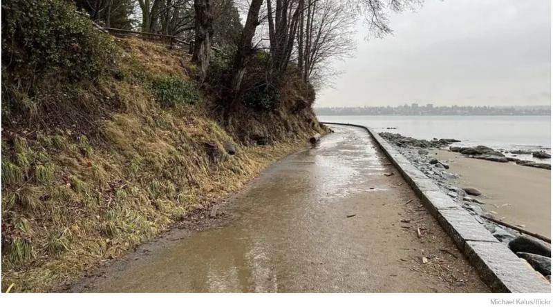
On Canada’s west coast, flood risk zones are expected to extend higher and further inland, particularly affecting populated areas in parts of Metro Vancouver south of the Fraser River, reports CBC News.
“It’s estimated 325,000 people in Canada will live on land falling in annual flood risk zones by 2100,” CBC writes, citing a new sea level data map by Climate Central, a non-profit group of scientists and communicators based in Princeton, New Jersey. “It’s a 10% increase from the group’s 2030 estimate of 295,000 people facing annual flood risk.”
Richmond, home of the Vancouver International Airport, as well as Delta and large chunks of Surrey, will lie below annual flood levels by 2100, CBC adds.
The costs of trying to keep the rising seas at bay are prohibitive. “We have about 67 kilometres of dikes in Delta and for us to bring them up to standard [can cost] C$2 billion, and that’s just for Delta,” said Mayor George Harvie. “It’s not going to happen.”
The province transferred responsibilities for operating and maintaining the dikes to local governments in 2011. Now, the cities would like the province to reinvolve itself, CBC writes.
Low-lying areas like Delta would do well to pursue nature-based solutions like wetland restoration, said Karen Kohfeld, director of Simon Fraser University’s School of Environmental Science. Restoring indigenous wetlands and saltwater marshes west and south of the Fraser River will “help protect the shoreline on a larger scale” than any dike ever could, she said. Lowering the intensity of ocean wave action, these liminal habitats help mitigate storm damage while shielding coasts from erosion.
Delta is indeed pursuing the wetland restoration option, CBC News writes. In partnership with the City of Surrey and Semiahmoo First Nation, Delta will help restore and extend the Mud Bay salt marsh. The $1.4-million project will see sediment and native plants steadily added to the marsh, so it can grow higher to form a barrier against rising seas.
Ice Loss Compounds Sea Level Rise in NWT
Climate Central’s new mapping tool shows large swathes of the coast near Tuktoyaktuk, NWT, under increasing threat of sea level rise in the coming decades. The problem is compounded by the loss of Arctic sea ice cover. The most immediate concern is the rapid erosion of an island that protects Tuktoyaktuk’s harbour.
Less sea ice means more open water across which storms can whip up waves that crash with greater eroding force against the island’s shores.
“Tuk Island is eroding at an average of 1.8 metres per year, and without intervention will be breached by the year 2050,” reports the non-profit Future Tuktoyaktuk.
Improved storm surge forecasting is on its way to the region this year. Meanwhile, “Tuktoyaktuk is working to expand its community-run climate monitoring program while leaders devise ways to protect the hamlet and its population in the longer term,” Cabin Radio reported last January.
“At present rates of erosion, sea level rise and permafrost thaw, the entire townsite will be unviable by 2050,” says Future Tuk.
Nova Scotia Bails on Coastal Protection
Though less immediately imperilled than Tuktoyaktuk, coastal communities in Nova Scotia are also seeing their exposure to rising seas compounded by loss of sea ice cover, said Joanna Eyquem, managing director of climate-resilient infrastructure at the University of Waterloo’s Intact Centre on Climate Adaptation.
“Reduced sea ice cover [in Atlantic Canada] will result in longer open water fetches and increased wave heights and storm surges during winter,” Eyquem told The Energy Mix, citing the Intact Centre’s 2022 report, Rising Seas and Shifting Sands. “More prolonged open water seasons will also result in increased exposure of shorelines to wave action and extreme water levels, increasing erosion in some areas,” she added.
Eyquem urged recognition of the dangers of installing “hard coastal protection” measures like sea walls to prevent erosion. That kind of infrastructure can “reduce sediment supply to downdrift areas further along the coast,” sediment that is vital to slowing erosion there.
“A functional systems-based approach to coastal management must be adopted to avoid undesirable impacts elsewhere within the system,” Eyquem said.
But that may be off the table for the time being. Dismaying many coastal residents, Premier Tim Houston’s government has pulled the plug on the long-awaited Coastal Protection Act (CPA), which was passed with all-party assent in 2019.
“Among other things, the act would have regulated how close people could build to the ocean based on assessments of sea level, storm projections, and information about the elevation and erosion risk of each section of coast,” writes Dalhousie University environmental studies professor Kate Sherren for The Conversation. The CPA “would have protected people and infrastructure, as well as sensitive coastal ecosystems, and left space for ocean dynamics,” but it has been tossed despite “overwhelming” public support.
Instead, the province is leaving coastline protection individual property owners, their efforts supported by a new government website listing helpful resources that include a new hazard map. “The lengthy disclaimer you need to agree to before you can access the map immediately erodes its trustworthiness,” Sherren says.


