How 2021's floods and heat waves are signs of what's to come
In 2021, extremely rare weather disasters became alarmingly common.
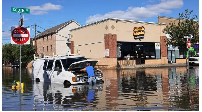
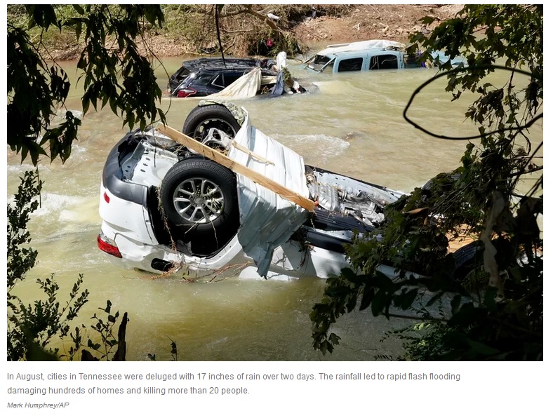
In Tennessee, cities were deluged with 17 inches of rain over two days. Dozens of people drowned in basement apartments and cars in New Jersey, when floodwater rose as the remnants of Hurricane Ida swept through. In the Pacific Northwest, heat-related illness sent almost 3,000 people to the emergency room when temperatures topped 116 degrees.
All are considered one in 1,000-year events, having only a 0.1% chance of happening in any given year. But as global temperatures rise, these kinds of extremes are happening more frequently.
Like two sides of the same coin, rising temperatures are making dry heat waves more intense, while also causing storms to release heavier deluges. Climate scientists only expect that trend to increase as humans continue releasing heat-trapping gases into the atmosphere.
Whether it was too much water or too much heat, extreme weather events in 2021 exposed major shortfalls in how prepared cities and governments are to handle them. Most of the country's homes, roads and public safety systems were designed for the climate of the last century, when the most extreme weather events currently occurring were considered improbable.
"I think the biggest lesson is that the past is not a good predictor of the future and to begin planning now for what the climate might be 20, 30 years from now," says David Easterling, climate scientist at the National Oceanic and Atmospheric Administration (NOAA).
Unprecedented heat waves
In late June, the weather forecast in Washington and Oregon read like something written for Southwestern deserts. Temperatures rose above 110 degrees, well into record-setting territory. An area of high pressure known as a heat dome locked dangerously hot air over the region, deflecting the clouds and cool breezes the region is accustomed to.
With many residents lacking air conditioning, the heat became a public health emergency. Thousands went to the hospital and more than 200 people died. Paved surfaces became perilously hot. Roads and infrastructure buckled. The effects were even worse in cities, where cement absorbs and radiates heat, pushing temperatures even higher.
As the climate gets hotter, extreme heat events are becoming significantly more likely. Globally, temperatures have already risen almost 2 degrees Fahrenheit (1.1 degrees Celsius). If temperatures reach 3.6 degrees Fahrenheit of warming (2 degrees Celsius), scientists predict that a 1-in-50 year heat wave is almost 14 times more likely to happen, according to a major climate assessment released this year by the Intergovernmental Panel on Climate Change (IPCC).
While climate scientists have tracked those overall trends for decades, they're now also homing in on how climate change is intensifying individual heat waves. According to a study by scientists with the World Weather Attribution collaborative, the Pacific Northwest heat wave was made 150 times more likely by the changing climate. In another new report, the American Meteorological Society (AMS) found that climate change influenced many of the 2020 heat waves as well.
"At this point, understanding climate change's role in a heat wave has become highly routine," says Stephanie Herring, a NOAA climate scientist who worked on the AMS report. "Around the world, it's extremely rare to find a heat event not made worse, to some degree, by climate change."
Overwhelming rainfall
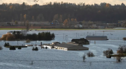
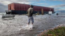
Just six months after the summer heat wave, British Columbia and the Pacific Northwest found themselves scrambling with another climate extreme. An intense winter storm flooded roads and homes, one of several rain-driven disasters this year that exposed how quickly cities can be overcome by water.
In August, heavy rainfall in Waverly, Tennessee led to rapid flash flooding, damaging hundreds of homes and killing more than 20 people. The 17 inches of rain was far outside the bounds of an extreme storm for the area, even more unlikely than a one in 1,000-year event.
Later that month, the remains of Hurricane Ida unleashed heavy rain across the Northeast, stunning many residents. As the streets filled with water, some were trapped in basement apartments and drowned. Others were overtaken in their cars. Authorities vowed to increase flood warnings and go door-to-door for evacuations in the future.
While every storm is different, rising temperatures are already increasing the capacity of storms to release more intense rain.
"Unfortunately, we're starting to see more and more of those rainfall events," Easterling says. "And the expectation is that in the future, because of warming, a warmer atmosphere holds much more moisture and that those events will continue to increase."
In most of the U.S., the biggest storms are already producing more rain. In the Northeast, those storms produced 55% more rainfall by 2016, compared to 1958, according to the last National Climate Assessment. Globally, the recent IPCC assessment finds that heavy storms will be 14% wetter if the planet warms 3.6 degrees Fahrenheit (2 degrees Celsius).
Most cities, including the stormwater systems that drain water away, aren't designed to handle the most extreme storms. Building infrastructure to handle the heaviest rainfall events can be costly. But while those storms were once thought to be few and far between, climate change is changing the equation.


